Socialpeta logo
  • Home
  • Products
    Ad IntelligenceCreative AnalysisMarket IntelligenceAI Copilot
  • Solutions
    GamesUtility AppsGenAI AppsShort DramaE-commerce
  • Blog
  • Resources
    Ad LibraryMobile App Top ChartsAcademyWebinarsMarketing GlossarySuccess Stories
Socialpeta logo
  • Home
  • Products
    Ad IntelligenceCreative AnalysisMarket IntelligenceAI Copilot
  • Solutions
    GamesUtility AppsGenAI AppsShort DramaE-commerce
  • Blog
  • Resources
    Ad LibraryMobile App Top ChartsAcademyWebinarsMarketing GlossarySuccess Stories
HomeApp StoreMilGPS
MilGPS app iconApp Store
App dataHistorical activity

MilGPS

See App Store listing details and the ad activity observed by SocialPeta.

App Store405835358Cascode Labs Pty Ltd
View full analysis in SocialPetaOpen on App Store

At a glance

Store status
Listed
Source market
United States
Rating
4.8
Data updated
Sep 28, 2026

Store intelligence

Store details

Listing details from the current store market, including the developer, version, price, and categories.

Seller / developer

Cascode Labs Pty Ltd

First released

Dec 1, 2010

Current version

7.24.1

Price

$12.99

In-app purchases

No

Age rating

4+

Source market

United States

Store categories and subcategories

AppsNavigationUtilities

Market performance

Downloads, revenue, and store availability

See MilGPS's estimated downloads, revenue, and available markets for the latest complete month.

Monthly estimates

August 2026

Compared with July 2026

984

Estimated downloads

-2.9%MoM

$29.1K

Estimated revenue

-0.3%MoM

Downloads and revenue are SocialPeta estimates based on public and observed data, not official store settlement figures.

Store coverage

45

Listed markets

United Arab EmiratesArgentinaAustraliaAzerbaijanBahrainCanadaChileChinaColombiaGermanyEgyptSpain+33

No preorder markets found.

Product information

About MilGPS

Read the store description and view the official screenshots.

MilGPS store screenshot 1
MilGPS store screenshot 2
MilGPS store screenshot 3
MilGPS store screenshot 4
MilGPS store screenshot 5
MilGPS store screenshot 6
MilGPS store screenshot 7
MilGPS store screenshot 8
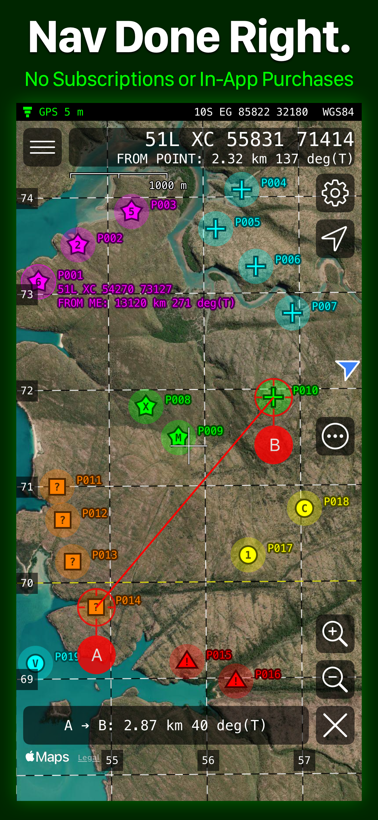
MilGPS is a field navigation tool designed for efficient use by trained navigators using MGRS coordinates. No in-app purchases or subscriptions. OVERVIEW - Display your current location and other info in large, clear text on customizable screens. - Create waypoints using your current location, map crosshairs, distance/direction projection or optimized coordinate entry. Organize waypoints into overlays and navigate to them by following an arrow or on the map. - Visualize your location and waypoints on a map with smooth scrolling grid lines/labels. Apple and Google online maps are included or supply your own offline maps in raster MBTiles format. OTHER FEATURES - Supports MGRS, USNG, UTM, Lat/Lon and OSNG location formats. - Supports a wide variety of map datums including WGS84, NAD27, OSGB36, AGD66 and ED50. - Use 3 different datums/location formats for location display and waypoint entry. - Supports a wide variety of angle, altitude, and distance formats. - Cell phone signal not required for basic navigation functionality. Online maps require a data connection. - Supports military date time groups for local/zulu time - Import and export waypoints via the standard GPX file format. Limited support for KML and CSV formats. Routes and tracks not supported. - Map ruler tool to measure distance/direction between two points on the map, snaps to waypoints NOT INCLUDED (YET) - Route planning - Track recording - Online mapping sources other than Apple and Google maps - Vector offline maps QUESTIONS support@milgps.com NOTES - WiFi-only iPads are not supported because they don't have a GPS receiver. - Mapping function requires a data connection. - Using GPS will shorten battery life. - Online maps are provided, hosted and updated by third parties. Maps may be inaccurate or censored. Map types and quality may change without notice. PRIVACY Because you can choose to use Google maps in the app, we are required to disclose the data collected by Google in our App Store listing. If you do not use Google maps minimal data is collected. See our privacy policy for details. WARNING YOUR USE OF MILGPS IS AT YOUR OWN RISK MilGPS is an aid to navigation only and is intended to be used in conjunction with other navigation methods and tools. MilGPS must not be used where relying on MilGPS could result in death, injury or financial loss. This includes use on military operations, live-firing activities, aviation and surveying use. MilGPS is not tested to military specifications and is not endorsed by the military of any nation. MilGPS is not a substitute for military issue equipment. Your use of MilGPS is governed by the standard App Store Licensed Application End User License Agreement.

Version records

Version History

See when each MilGPS version was released and its store description.

View full version history
VersionUpdated onDescription

Version

7.24.1

Updated on

Sep 15, 2026

Description

MilGPS is a field navigation tool designed for efficient use by trained navigators using MGRS coordinates. No in-app purchases or subscriptions. OVERVIEW - Display your current location and other info in large, clear text on customizable screens. - Create waypoints using your current location, map crosshairs, distance/direction projection or optimized coordinate entry. Organize waypoints into overlays and navigate to them by following an arrow or on the map. - Visualize your location and waypoints on a map with smooth scrolling grid lines/labels. Apple and Google online maps are included or supply your own offline maps in raster MBTiles format. OTHER FEATURES - Supports MGRS, USNG, UTM, Lat/Lon and OSNG location formats. - Supports a wide variety of map datums including WGS84, NAD27, OSGB36, AGD66 and ED50. - Use 3 different datums/location formats for location display and waypoint entry. - Supports a wide variety of angle, altitude, and distance formats. - Cell phone signal not required for basic navigation functionality. Online maps require a data connection. - Supports military date time groups for local/zulu time - Import and export waypoints via the standard GPX file format. Limited support for KML and CSV formats. Routes and tracks not supported. - Map ruler tool to measure distance/direction between two points on the map, snaps to waypoints NOT INCLUDED (YET) - Route planning - Track recording - Online mapping sources other than Apple and Google maps - Vector offline maps QUESTIONS support@milgps.com NOTES - WiFi-only iPads are not supported because they don't have a GPS receiver. - Mapping function requires a data connection. - Using GPS will shorten battery life. - Online maps are provided, hosted and updated by third parties. Maps may be inaccurate or censored. Map types and quality may change without notice. PRIVACY Because you can choose to use Google maps in the app, we are required to disclose the data collected by Google in our App Store listing. If you do not use Google maps minimal data is collected. See our privacy policy for details. WARNING YOUR USE OF MILGPS IS AT YOUR OWN RISK MilGPS is an aid to navigation only and is intended to be used in conjunction with other navigation methods and tools. MilGPS must not be used where relying on MilGPS could result in death, injury or financial loss. This includes use on military operation

Version

7.24.0

Updated on

Aug 20, 2026

Description

MilGPS is a field navigation tool designed for efficient use by trained navigators using MGRS coordinates. No in-app purchases or subscriptions. OVERVIEW - Display your current location and other info in large, clear text on customizable screens. - Create waypoints using your current location, map crosshairs, distance/direction projection or optimized coordinate entry. Organize waypoints into overlays and navigate to them by following an arrow or on the map. - Visualize your location and waypoints on a map with smooth scrolling grid lines/labels. Apple and Google online maps are included or supply your own offline maps in raster MBTiles format. OTHER FEATURES - Supports MGRS, USNG, UTM, Lat/Lon and OSNG location formats. - Supports a wide variety of map datums including WGS84, NAD27, OSGB36, AGD66 and ED50. - Use 3 different datums/location formats for location display and waypoint entry. - Supports a wide variety of angle, altitude, and distance formats. - Cell phone signal not required for basic navigation functionality. Online maps require a data connection. - Supports military date time groups for local/zulu time - Import and export waypoints via the standard GPX file format. Limited support for KML and CSV formats. Routes and tracks not supported. - Map ruler tool to measure distance/direction between two points on the map, snaps to waypoints NOT INCLUDED (YET) - Route planning - Track recording - Online mapping sources other than Apple and Google maps - Vector offline maps QUESTIONS support@milgps.com NOTES - WiFi-only iPads are not supported because they don't have a GPS receiver. - Mapping function requires a data connection. - Using GPS will shorten battery life. - Online maps are provided, hosted and updated by third parties. Maps may be inaccurate or censored. Map types and quality may change without notice. PRIVACY Because you can choose to use Google maps in the app, we are required to disclose the data collected by Google in our App Store listing. If you do not use Google maps minimal data is collected. See our privacy policy for details. WARNING YOUR USE OF MILGPS IS AT YOUR OWN RISK MilGPS is an aid to navigation only and is intended to be used in conjunction with other navigation methods and tools. MilGPS must not be used where relying on MilGPS could result in death, injury or financial loss. This includes use on military operation

Version

7.22.1

Updated on

Jun 20, 2026

Description

MilGPS is a field navigation tool designed for efficient use by trained navigators using MGRS coordinates. No in-app purchases or subscriptions. OVERVIEW - Display your current location and other info in large, clear text on customizable screens. - Create waypoints using your current location, map crosshairs, distance/direction projection or optimized coordinate entry. Organize waypoints into overlays and navigate to them by following an arrow or on the map. - Visualize your location and waypoints on a map with smooth scrolling grid lines/labels. Apple and Google online maps are included or supply your own offline maps in raster MBTiles format. OTHER FEATURES - Supports MGRS, USNG, UTM, Lat/Lon and OSNG location formats. - Supports a wide variety of map datums including WGS84, NAD27, OSGB36, AGD66 and ED50. - Use 3 different datums/location formats for location display and waypoint entry. - Supports a wide variety of angle, altitude, and distance formats. - Cell phone signal not required for basic navigation functionality. Online maps require a data connection. - Supports military date time groups for local/zulu time - Import and export waypoints via the standard GPX file format. Limited support for KML and CSV formats. Routes and tracks not supported. - Map ruler tool to measure distance/direction between two points on the map, snaps to waypoints NOT INCLUDED (YET) - Route planning - Track recording - Online mapping sources other than Apple and Google maps - Vector offline maps QUESTIONS support@milgps.com NOTES - WiFi-only iPads are not supported because they don't have a GPS receiver. - Mapping function requires a data connection. - Using GPS will shorten battery life. - Online maps are provided, hosted and updated by third parties. Maps may be inaccurate or censored. Map types and quality may change without notice. PRIVACY Because you can choose to use Google maps in the app, we are required to disclose the data collected by Google in our App Store listing. If you do not use Google maps minimal data is collected. See our privacy policy for details. WARNING YOUR USE OF MILGPS IS AT YOUR OWN RISK MilGPS is an aid to navigation only and is intended to be used in conjunction with other navigation methods and tools. MilGPS must not be used where relying on MilGPS could result in death, injury or financial loss. This includes use on military operation

Version

7.21.0

Updated on

Apr 23, 2026

Description

MilGPS is a field navigation tool designed for efficient use by trained navigators using MGRS coordinates. No in-app purchases or subscriptions. OVERVIEW - Display your current location and other info in large, clear text on customizable screens. - Create waypoints using your current location, map crosshairs, distance/direction projection or optimized coordinate entry. Organize waypoints into overlays and navigate to them by following an arrow or on the map. - Visualize your location and waypoints on a map with smooth scrolling grid lines/labels. Apple and Google online maps are included or supply your own offline maps in raster MBTiles format. OTHER FEATURES - Supports MGRS, USNG, UTM, Lat/Lon and OSNG location formats. - Supports a wide variety of map datums including WGS84, NAD27, OSGB36, AGD66 and ED50. - Use 3 different datums/location formats for location display and waypoint entry. - Supports a wide variety of angle, altitude, and distance formats. - Cell phone signal not required for basic navigation functionality. Online maps require a data connection. - Supports military date time groups for local/zulu time - Import and export waypoints via the standard GPX file format. Limited support for KML and CSV formats. Routes and tracks not supported. - Map ruler tool to measure distance/direction between two points on the map, snaps to waypoints NOT INCLUDED (YET) - Route planning - Track recording - Online mapping sources other than Apple and Google maps - Vector offline maps QUESTIONS support@milgps.com NOTES - WiFi-only iPads are not supported because they don't have a GPS receiver. - Mapping function requires a data connection. - Using GPS will shorten battery life. - Online maps are provided, hosted and updated by third parties. Maps may be inaccurate or censored. Map types and quality may change without notice. PRIVACY Because you can choose to use Google maps in the app, we are required to disclose the data collected by Google in our App Store listing. If you do not use Google maps minimal data is collected. See our privacy policy for details. WARNING YOUR USE OF MILGPS IS AT YOUR OWN RISK MilGPS is an aid to navigation only and is intended to be used in conjunction with other navigation methods and tools. MilGPS must not be used where relying on MilGPS could result in death, injury or financial loss. This includes use on military operation

Version

7.20.2

Updated on

Apr 10, 2026

Description

MilGPS is a field navigation tool designed for efficient use by trained navigators using MGRS coordinates. No in-app purchases or subscriptions. OVERVIEW - Display your current location and other info in large, clear text on customizable screens. - Create waypoints using your current location, map crosshairs, distance/direction projection or optimized coordinate entry. Organize waypoints into overlays and navigate to them by following an arrow or on the map. - Visualize your location and waypoints on a map with smooth scrolling grid lines/labels. Apple and Google online maps are included or supply your own offline maps in raster MBTiles format. OTHER FEATURES - Supports MGRS, USNG, UTM, Lat/Lon and OSNG location formats. - Supports a wide variety of map datums including WGS84, NAD27, OSGB36, AGD66 and ED50. - Use 3 different datums/location formats for location display and waypoint entry. - Supports a wide variety of angle, altitude, and distance formats. - Cell phone signal not required for basic navigation functionality. Online maps require a data connection. - Supports military date time groups for local/zulu time - Import and export waypoints via the standard GPX file format. Limited support for KML and CSV formats. Routes and tracks not supported. - Map ruler tool to measure distance/direction between two points on the map, snaps to waypoints NOT INCLUDED (YET) - Route planning - Track recording - Online mapping sources other than Apple and Google maps - Vector offline maps QUESTIONS support@milgps.com NOTES - WiFi-only iPads are not supported because they don't have a GPS receiver. - Mapping function requires a data connection. - Using GPS will shorten battery life. - Online maps are provided, hosted and updated by third parties. Maps may be inaccurate or censored. Map types and quality may change without notice. PRIVACY Because you can choose to use Google maps in the app, we are required to disclose the data collected by Google in our App Store listing. If you do not use Google maps minimal data is collected. See our privacy policy for details. WARNING YOUR USE OF MILGPS IS AT YOUR OWN RISK MilGPS is an aid to navigation only and is intended to be used in conjunction with other navigation methods and tools. MilGPS must not be used where relying on MilGPS could result in death, injury or financial loss. This includes use on military operation

Version

7.20.1

Updated on

Mar 19, 2026

Description

MilGPS is a field navigation tool designed for efficient use by trained navigators using MGRS coordinates. No in-app purchases or subscriptions. OVERVIEW - Display your current location and other info in large, clear text on customizable screens. - Create waypoints using your current location, map crosshairs, distance/direction projection or optimized coordinate entry. Organize waypoints into overlays and navigate to them by following an arrow or on the map. - Visualize your location and waypoints on a map with smooth scrolling grid lines/labels. Apple and Google online maps are included or supply your own offline maps in raster MBTiles format. OTHER FEATURES - Supports MGRS, USNG, UTM, Lat/Lon and OSNG location formats. - Supports a wide variety of map datums including WGS84, NAD27, OSGB36, AGD66 and ED50. - Use 3 different datums/location formats for location display and waypoint entry. - Supports a wide variety of angle, altitude, and distance formats. - Cell phone signal not required for basic navigation functionality. Online maps require a data connection. - Supports military date time groups for local/zulu time - Import and export waypoints via the standard GPX file format. Limited support for KML and CSV formats. Routes and tracks not supported. - Map ruler tool to measure distance/direction between two points on the map, snaps to waypoints NOT INCLUDED (YET) - Route planning - Track recording - Online mapping sources other than Apple and Google maps - Vector offline maps QUESTIONS support@milgps.com NOTES - WiFi-only iPads are not supported because they don't have a GPS receiver. - Mapping function requires a data connection. - Using GPS will shorten battery life. - Online maps are provided, hosted and updated by third parties. Maps may be inaccurate or censored. Map types and quality may change without notice. PRIVACY Because you can choose to use Google maps in the app, we are required to disclose the data collected by Google in our App Store listing. If you do not use Google maps minimal data is collected. See our privacy policy for details. WARNING YOUR USE OF MILGPS IS AT YOUR OWN RISK MilGPS is an aid to navigation only and is intended to be used in conjunction with other navigation methods and tools. MilGPS must not be used where relying on MilGPS could result in death, injury or financial loss. This includes use on military operation

Version

7.20.0

Updated on

Mar 13, 2026

Description

MilGPS is a field navigation tool designed for efficient use by trained navigators using MGRS coordinates. No in-app purchases or subscriptions. OVERVIEW - Display your current location and other info in large, clear text on customizable screens. - Create waypoints using your current location, map crosshairs, distance/direction projection or optimized coordinate entry. Organize waypoints into overlays and navigate to them by following an arrow or on the map. - Visualize your location and waypoints on a map with smooth scrolling grid lines/labels. Apple and Google online maps are included or supply your own offline maps in raster MBTiles format. OTHER FEATURES - Supports MGRS, USNG, UTM, Lat/Lon and OSNG location formats. - Supports a wide variety of map datums including WGS84, NAD27, OSGB36, AGD66 and ED50. - Use 3 different datums/location formats for location display and waypoint entry. - Supports a wide variety of angle, altitude, and distance formats. - Cell phone signal not required for basic navigation functionality. Online maps require a data connection. - Supports military date time groups for local/zulu time - Import and export waypoints via the standard GPX file format. Limited support for KML and CSV formats. Routes and tracks not supported. - Map ruler tool to measure distance/direction between two points on the map, snaps to waypoints NOT INCLUDED (YET) - Route planning - Track recording - Online mapping sources other than Apple and Google maps - Vector offline maps QUESTIONS support@milgps.com NOTES - WiFi-only iPads are not supported because they don't have a GPS receiver. - Mapping function requires a data connection. - Using GPS will shorten battery life. - Online maps are provided, hosted and updated by third parties. Maps may be inaccurate or censored. Map types and quality may change without notice. PRIVACY Because you can choose to use Google maps in the app, we are required to disclose the data collected by Google in our App Store listing. If you do not use Google maps minimal data is collected. See our privacy policy for details. WARNING YOUR USE OF MILGPS IS AT YOUR OWN RISK MilGPS is an aid to navigation only and is intended to be used in conjunction with other navigation methods and tools. MilGPS must not be used where relying on MilGPS could result in death, injury or financial loss. This includes use on military operation

Version

7.19.0

Updated on

Feb 13, 2026

Description

MilGPS is a field navigation tool designed for efficient use by trained navigators using MGRS coordinates. No in-app purchases or subscriptions. OVERVIEW - Display your current location and other info in large, clear text on customizable screens. - Create waypoints using your current location, map crosshairs, distance/direction projection or optimized coordinate entry. Organize waypoints into overlays and navigate to them by following an arrow or on the map. - Visualize your location and waypoints on a map with smooth scrolling grid lines/labels. Apple and Google online maps are included or supply your own offline maps in raster MBTiles format. OTHER FEATURES - Supports MGRS, USNG, UTM, Lat/Lon and OSNG location formats. - Supports a wide variety of map datums including WGS84, NAD27, OSGB36, AGD66 and ED50. - Use 3 different datums/location formats for location display and waypoint entry. - Supports a wide variety of angle, altitude, and distance formats. - Cell phone signal not required for basic navigation functionality. Online maps require a data connection. - Supports military date time groups for local/zulu time - Import and export waypoints via the standard GPX file format. Limited support for KML and CSV formats. Routes and tracks not supported. - Map ruler tool to measure distance/direction between two points on the map, snaps to waypoints NOT INCLUDED (YET) - Route planning - Track recording - Online mapping sources other than Apple and Google maps - Vector offline maps QUESTIONS support@milgps.com NOTES - WiFi-only iPads are not supported because they don't have a GPS receiver. - Mapping function requires a data connection. - Using GPS will shorten battery life. - Online maps are provided, hosted and updated by third parties. Maps may be inaccurate or censored. Map types and quality may change without notice. PRIVACY Because you can choose to use Google maps in the app, we are required to disclose the data collected by Google in our App Store listing. If you do not use Google maps minimal data is collected. See our privacy policy for details. WARNING YOUR USE OF MILGPS IS AT YOUR OWN RISK MilGPS is an aid to navigation only and is intended to be used in conjunction with other navigation methods and tools. MilGPS must not be used where relying on MilGPS could result in death, injury or financial loss. This includes use on military operation

Version

7.18.0

Updated on

Jan 15, 2026

Description

MilGPS is a field navigation tool designed for efficient use by trained navigators using MGRS coordinates. No in-app purchases or subscriptions. OVERVIEW - Display your current location and other info in large, clear text on customizable screens. - Create waypoints using your current location, map crosshairs, distance/direction projection or optimized coordinate entry. Organize waypoints into overlays and navigate to them by following an arrow or on the map. - Visualize your location and waypoints on a map with smooth scrolling grid lines/labels. Apple and Google online maps are included or supply your own offline maps in raster MBTiles format. OTHER FEATURES - Supports MGRS, USNG, UTM, Lat/Lon and OSNG location formats. - Supports a wide variety of map datums including WGS84, NAD27, OSGB36, AGD66 and ED50. - Use 3 different datums/location formats for location display and waypoint entry. - Supports a wide variety of angle, altitude, and distance formats. - Cell phone signal not required for basic navigation functionality. Online maps require a data connection. - Supports military date time groups for local/zulu time - Import and export waypoints via the standard GPX file format. Limited support for KML and CSV formats. Routes and tracks not supported. - Map ruler tool to measure distance/direction between two points on the map, snaps to waypoints NOT INCLUDED (YET) - Route planning - Track recording - Online mapping sources other than Apple and Google maps - Vector offline maps QUESTIONS support@milgps.com NOTES - WiFi-only iPads are not supported because they don't have a GPS receiver. - Mapping function requires a data connection. - Using GPS will shorten battery life. - Online maps are provided, hosted and updated by third parties. Maps may be inaccurate or censored. Map types and quality may change without notice. PRIVACY Because you can choose to use Google maps in the app, we are required to disclose the data collected by Google in our App Store listing. If you do not use Google maps minimal data is collected. See our privacy policy for details. WARNING YOUR USE OF MILGPS IS AT YOUR OWN RISK MilGPS is an aid to navigation only and is intended to be used in conjunction with other navigation methods and tools. MilGPS must not be used where relying on MilGPS could result in death, injury or financial loss. This includes use on military operation

Version

7.17.0

Updated on

Nov 20, 2025

Description

MilGPS is a field navigation tool designed for efficient use by trained navigators using MGRS coordinates. No in-app purchases or subscriptions. OVERVIEW - Display your current location and other info in large, clear text on customizable screens. - Create waypoints using your current location, map crosshairs, distance/direction projection or optimized coordinate entry. Organize waypoints into overlays and navigate to them by following an arrow or on the map. - Visualize your location and waypoints on a map with smooth scrolling grid lines/labels. Apple and Google online maps are included or supply your own offline maps in raster MBTiles format. OTHER FEATURES - Supports MGRS, USNG, UTM, Lat/Lon and OSNG location formats. - Supports a wide variety of map datums including WGS84, NAD27, OSGB36, AGD66 and ED50. - Use 3 different datums/location formats for location display and waypoint entry. - Supports a wide variety of angle, altitude, and distance formats. - Cell phone signal not required for basic navigation functionality. Online maps require a data connection. - Supports military date time groups for local/zulu time - Import and export waypoints via the standard GPX file format. Limited support for KML and CSV formats. Routes and tracks not supported. - Map ruler tool to measure distance/direction between two points on the map, snaps to waypoints NOT INCLUDED (YET) - Route planning - Track recording - Online mapping sources other than Apple and Google maps - Vector offline maps QUESTIONS support@milgps.com NOTES - WiFi-only iPads are not supported because they don't have a GPS receiver. - Mapping function requires a data connection. - Using GPS will shorten battery life. - Online maps are provided, hosted and updated by third parties. Maps may be inaccurate or censored. Map types and quality may change without notice. PRIVACY Because you can choose to use Google maps in the app, we are required to disclose the data collected by Google in our App Store listing. If you do not use Google maps minimal data is collected. See our privacy policy for details. WARNING YOUR USE OF MILGPS IS AT YOUR OWN RISK MilGPS is an aid to navigation only and is intended to be used in conjunction with other navigation methods and tools. MilGPS must not be used where relying on MilGPS could result in death, injury or financial loss. This includes use on military operation

Ranking preview

Current store rankings

Rankings for United States over the past 30 days. Open SocialPeta for daily charts and more categories.

View full ranking history

Top Grossing

Map & Nacigation

Current rank

#75

30-day best: #46

Previous rank: #54

Sep 27, 2026

Top Paid

Map & Nacigation

Current rank

#1

30-day best: #1

Previous rank: #1

Sep 27, 2026

Related apps

Competitors and related apps

Find more apps with a similar category, developer, or advertising pattern.

Advertising intelligence

Observed advertising activity

Channels, countries, and creative volume observed by SocialPeta in the past 30 days.

View full analysis in SocialPeta

0

Creatives observed in the last 30 days

1

Cumulative active days observed

0

Advertising channels observed

0

Countries and regions observed

Top observed channels

This preview is currently unavailable.

Top observed countries

This preview is currently unavailable.

First observed: Jan 1, 1970Last observed: Jan 1, 1970Observed activity only

More data

Continue in SocialPeta

Sign in to view full trends, creative analysis, audience data, and history. You can also filter and export the results.

View full analysis in SocialPeta
SocialPeta full app ranking history interface
Product interface preview

Full rankings and history

View daily ranking charts and compare categories or markets.
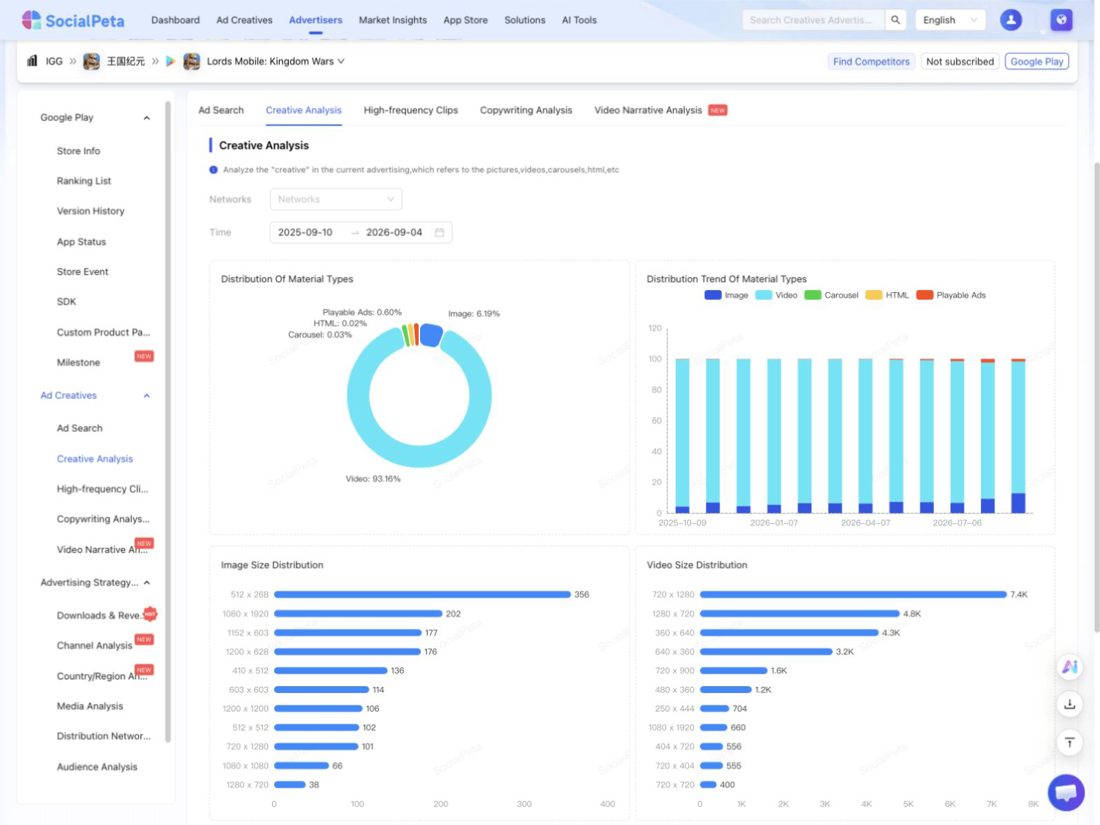
Data available
Open this analysis in SocialPeta
SocialPeta creative analysis interface
Product interface preview

Creative and message analysis

Compare creative formats, dimensions, duration, recurring clips, and ad copy.
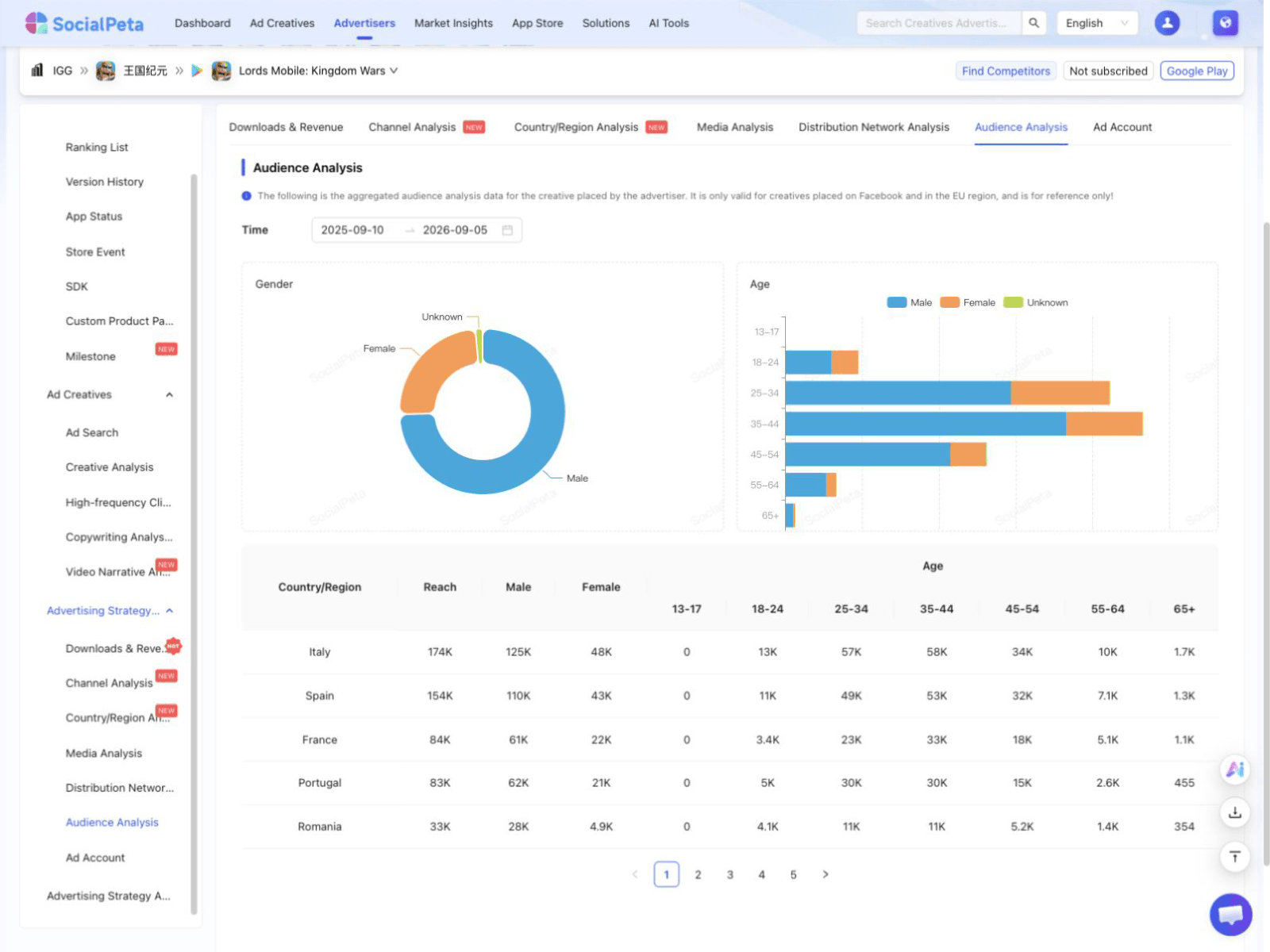
Data available
Open this analysis in SocialPeta
SocialPeta audience analysis interface
Product interface preview

Audience and distribution analysis

View audiences, publishers, networks, channels, countries, and delivery platforms.
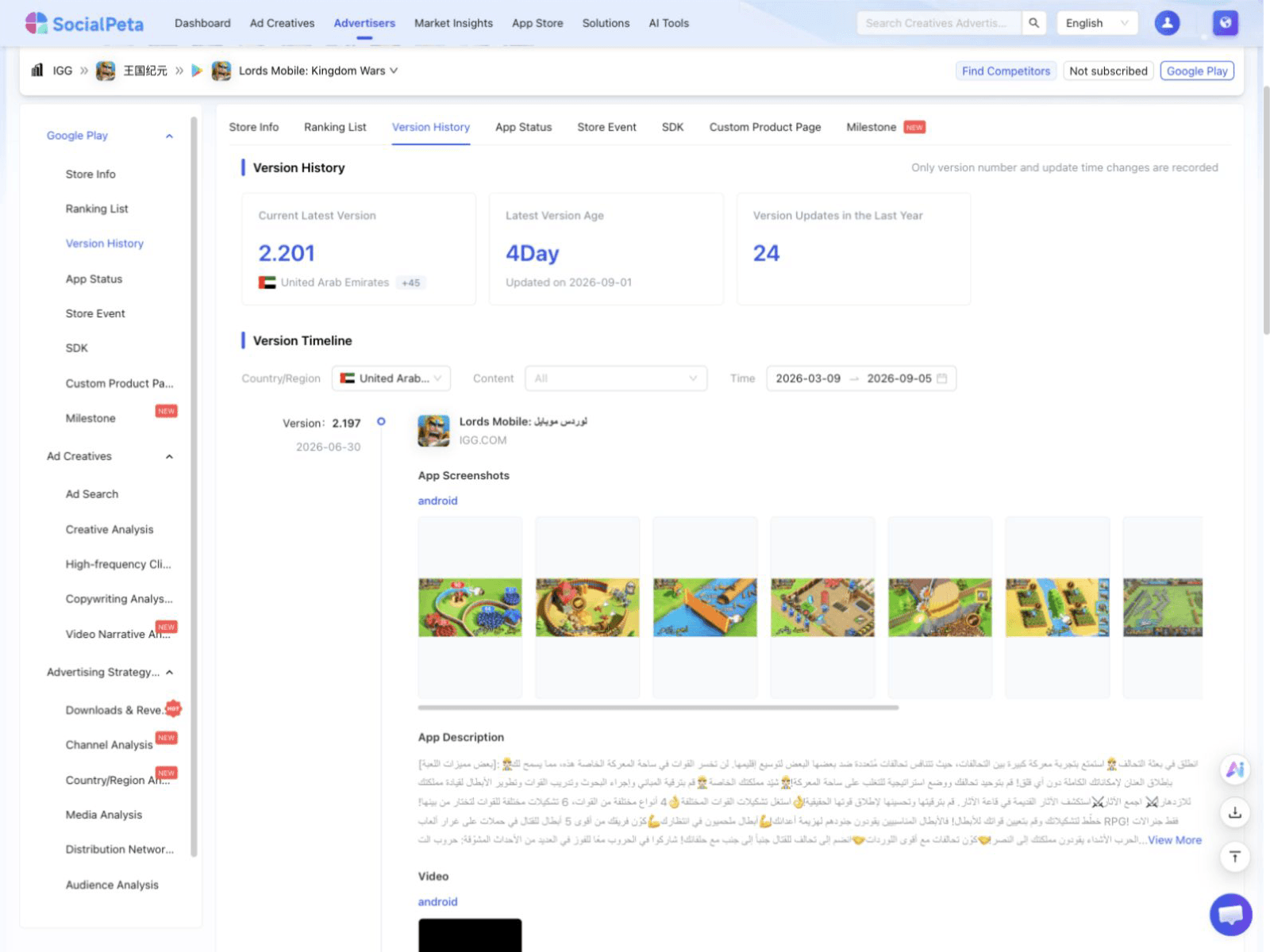
Data available
Open this analysis in SocialPeta
SocialPeta app version history interface
Product interface preview

App lifecycle and store history

View version changes, listing status, store events, SDKs, and custom product page history.

Data available
Open this analysis in SocialPeta

About this data

Ad figures only cover activity observed by SocialPeta and do not represent the advertiser's full media plan. Store details come from the current source market. Paid data is not included in this page.

Public data last updated Sep 28, 2026
SocialPeta

SocialPeta is a leading ad intelligence platform with a database of 1.7B+ creatives across 80+ countries. It provides competitive analysis and cost insights to optimize advertising strategies and drive global growth.

Contact Us

  • +86 135 81833414
  • +86-18910503414
  • summer@socialpeta.com

Links

  • Home
  • Blog
  • Ad Spy Tool
  • Ad Intelligence Platform
  • Top Grossing Mobile Games
  • Monthly Mobile Game Rankings
  • About Us
  • Contact Us

Resources

  • Ad Library
  • Mobile App Top Charts
  • Academy
  • Webinars
  • Tutorials
  • Marketing Glossary
  • Success Stories

Social Media

Products

  • Ad Intelligence
  • Creative Analysis
  • Market Intelligence
  • AI Copilot

Solutions

  • Games
  • Utility Apps
  • GenAI Apps
  • Short Drama
  • E-commerce

© Copyright 2026 SocialPeta

Launched on Fazier
  • Refund Policy
  • Terms of Service
  • Privacy Policy