月度预估
2026年10月
9.8万
预估下载量
-50.3%环比
US$102.3万
预估收入
-74.2%



这里汇总了 Google Play 商店信息,以及 SocialPeta 监测到的广告投放数据
商店情报
以下信息取自当前商店市场,包括开发者、版本、价格和分类
供应商 / 开发者
onXmaps
市场表现
查看 onX Hunt: Offline Hunting Maps 最近一个完整月份的预估下载、收入和上架市场
月度预估
2026年10月
9.8万
预估下载量
US$102.3万
预估收入
产品信息
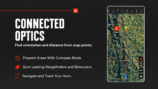
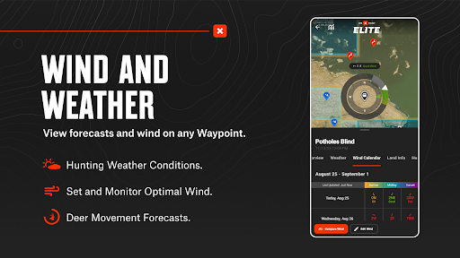
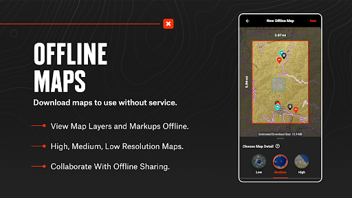
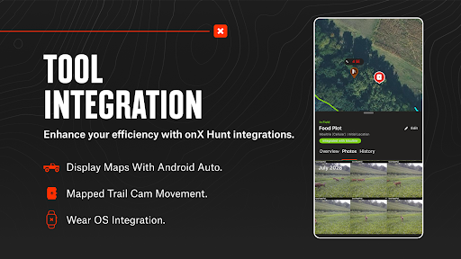
查看应用在商店中的介绍和官方截图
限时内容
查看 onX Hunt: Offline Hunting Maps 最近在商店发布的活动和开放时间
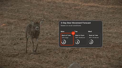
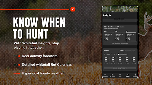
Stop guessing. Know when to hunt in your area with Deer Movement Forecast. View predicted whitetail activity based on 100+ million anonymized trail camera images cross referenced with 20+ weather factors to determine when deer in your area are most likely to move. If a cold front rolls in, wind shifts, or pressure drops, your predictions update in real-time so you can adjust your hunt strategy on the fly.
版本记录
查看 onX Hunt: Offline Hunting Maps 各版本的更新时间和商店描述
版本
varies_with_device_2026-10-23更新时间
描述
排名预览
这里显示 美国 市场近 30 天的排名,完整日线和更多分类可在 SocialPeta 中查看
免费榜
当前排名
#2
近 30 天最佳: #1
上期排名: #3
2026年11月3日
畅销榜
相关应用
按品类、开发者和相似投放查找更多应用
广告情报
以下是 SocialPeta 近 30 天监测到的渠道、国家和广告素材量
1,097
近 30 天监测素材量
3,604
累计监测活跃天数
样本素材
浏览近期监测到的图片、视频、轮播和试玩广告
onXmaps, Inc
 YouTube
该样本暂无可公开展示的广告文案

onXmaps, Inc
YouTube
该样本暂无可公开展示的广告文案
onXmaps, Inc
YouTube
该样本暂无可公开展示的广告文案
onXmaps, Inc
YouTube
该样本暂无可公开展示的广告文案
onXmaps, Inc
YouTube
该样本暂无可公开展示的广告文案

onXmaps, Inc
YouTube
该样本暂无可公开展示的广告文案
onXmaps, Inc
YouTube
该样本暂无可公开展示的广告文案
onXmaps, Inc
YouTube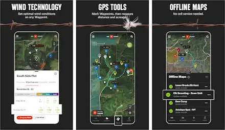
该样本暂无可公开展示的广告文案
onXmaps, Inc
YouTube
该样本暂无可公开展示的广告文案
onXmaps, Inc
YouTube
该样本暂无可公开展示的广告文案
onXmaps, Inc
YouTube
Plan your hunt with topo maps, property lines, GPS navigation, and map layers
onXmaps, Inc
YouTube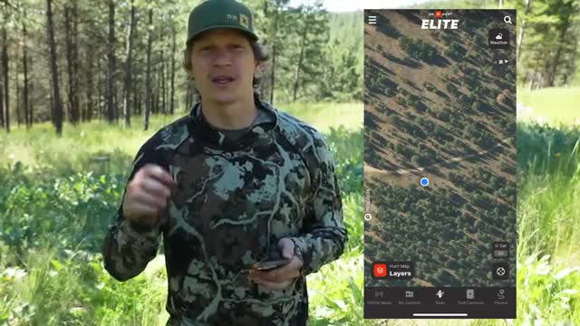
Plan your hunt with topo maps, property lines, GPS navigation, and map layers
onXmaps, Inc
YouTube
该样本暂无可公开展示的广告文案
onXmaps, Inc
YouTube
Plan your hunt with topo maps, property lines, GPS navigation, and map layers
onXmaps, Inc
YouTube
该样本暂无可公开展示的广告文案
更多数据
登录 SocialPeta 后可查看完整趋势、素材分析、受众分布和历史数据,也可以筛选或导出结果
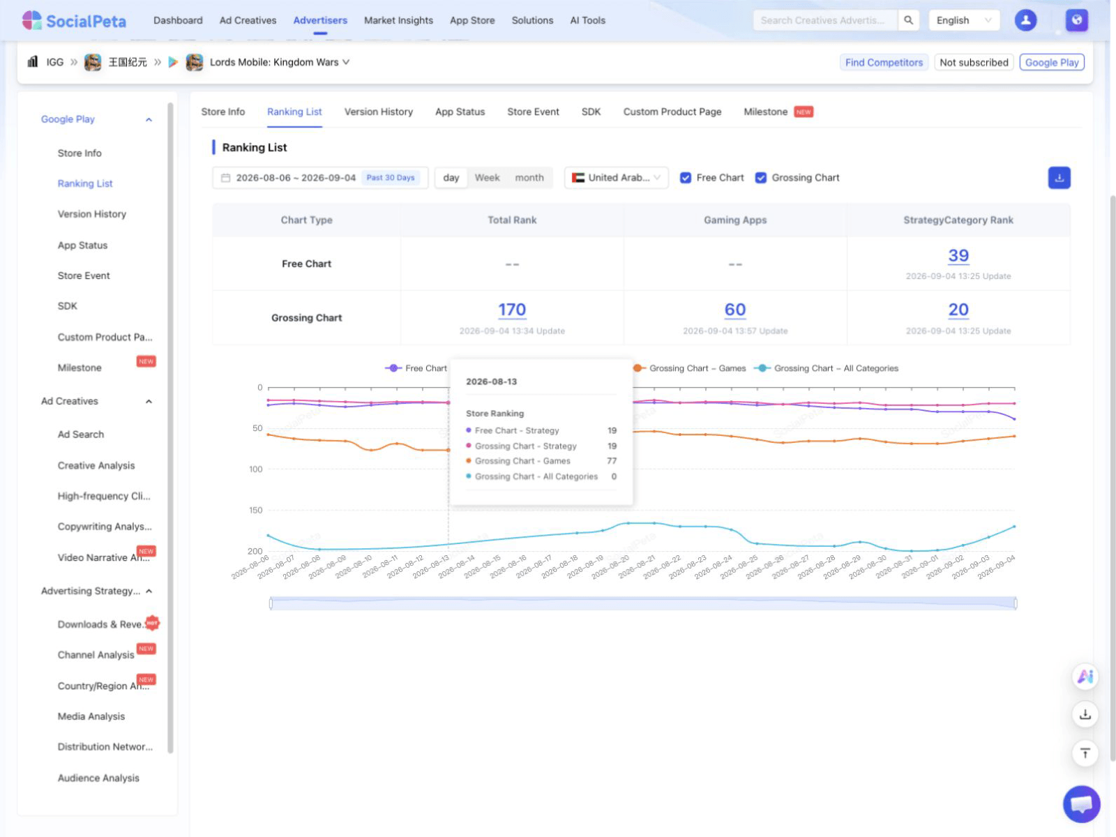 产品界面预览
查看每日排名曲线,并对比不同分类和市场
广告数据仅包含 SocialPeta 监测到的活动,不等同于广告主的全部投放。商店信息取自当前数据市场,付费数据不会写入本页
公开数据更新于 2026年11月4日
首次上架
2013年11月8日
当前版本
varies_with_device_2026-10-23
价格
0.00
应用内购买
支持
年龄分级
Everyone
数据市场
美国
商店分类与细分分类
下载量与收入为 SocialPeta 基于公开及监测数据生成的预估值,不代表商店官方结算数据
商店覆盖
46
已上架市场
暂无预订市场记录
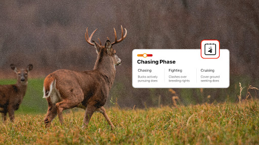
Clearly understand each phase of the rut, when it will happen where you hunt, and the tactics you need to deploy to find success. Follow the Rut Calendar with a countdown and hunt each phase with precision. Check in on local hunter reports and contribute your own by reporting in on deer activity in your vicinity.
前往活动页面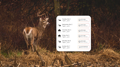
A successful whitetail hunt starts long before the truck door shuts and the hike in starts. When you plan your hunts using deer movement forecast, you get the inside scoop on where the deer are likely to be. Trail camera integration puts your cell cam photos on your phone and ties them to waypoints where they were taken. Add up all these little details, and you’ll find out why onX Hunt is the most powerful tool available to whitetail hunters around the country.
前往活动页面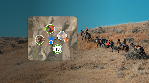
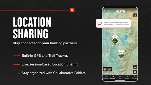
No matter what your objective, planning and preparation are critical for a safe and successful hunt. Group location sharing keeps everyone on the same page and eliminates uncertainty. Offline maps keep you in the know even when cell service is miles behind you. With collaborative folders, you and your hunting buddies can work from the same playbook. Don’t head into the season unprepared. Let onX Hunt help you find success.
前往活动页面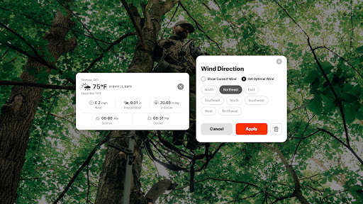
Let trail cameras and glassing tell you a buck’s story. Start paying attention to what wind a buck favors and which direction he comes from in the evening. Monitor weather forecasts and wind patterns. Mark water sources with waypoints, and use the tracker to plan covert routes you can reference in the dark. Predict whitetail patterns with deer movement forecasts to visualize how deer move across a property.
前往活动页面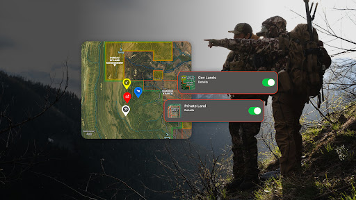
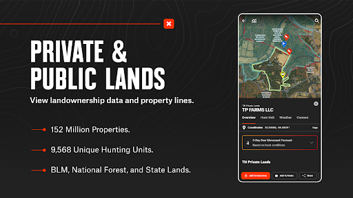
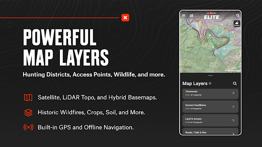
Confirm public and private land opportunities and pinpoint where you’ll need to set up camp. Map out your access routes or study road and trail systems with map layers. Use the lidar basemap to find “hidden” benches or identify your next campsite with 3D terrain. Download offline maps to access all of your markups in the field without cell coverage. Access the tools you need to find more success this elk season.
前往活动页面
When something goes wrong in the field, onX SOS connects you directly to a 24/7 professional rescue team that coordinates help and covers rescue and evacuation costs—no separate hardware, two-way communication, no claims process. Add onX SOS to your existing Membership and receive the most complete rescue coverage at the lowest price in the market. Feel confident to go anywhere with coverage across 220 countries, no altitude or activity limits, no deductibles, and no caps.
前往活动页面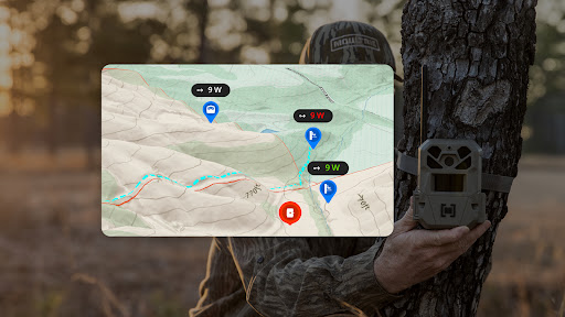
Scout for the season ahead and find trail camera placements that produce. View 3D lidar maps to find the ridges, pinch points, and low-laying terrain that will work to your advantage. Gain intel on wind direction with optimal wind and hourly weather forecasts. Track your deer, share your findings, and be in the right spot on opening day. Receive, organize, and analyze your trail camera photos with onX Hunt.
前往活动页面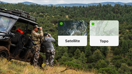
Take advantage of onX Hunt's extensive hunting guides and scouting tools to prepare for the upcoming season. Analyze terrain with 3D lidar topo maps or recent satellite imagery. Pinpoint natural travel corridors, drainages, and other features that can influence animal movements. Evaluate a hunting area and save map markups (Waypoints, Lines, Shapes, and Tracks) on your desktop. onX Hunt syncs your data across all of your devices, so you can be more efficient when you hit the field.
前往活动页面Take advantage of onX Hunt's extensive hunting guides and scouting tools to prepare for the upcoming season. Analyze terrain with 3D lidar topo maps or recent satellite imagery. Pinpoint natural travel corridors, drainages, and other features that can influence animal movements. Evaluate a hunting area and save map markups (Waypoints, Lines, Shapes, and Tracks) on your desktop. onX Hunt syncs your data across all of your devices, so you can be more efficient when you hit the field.
前往活动页面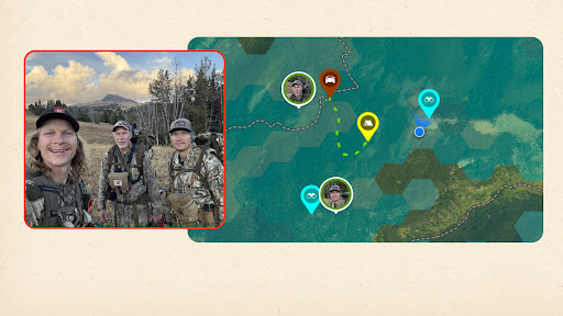
You had a great teacher. Now, make new memories together with onX Hunt. Live Location Sharing lets your group split up, stay spaced out, and regroup with confidence. Sharing supports up to 10 people in a single, private session with locations updating every five seconds. Nothing is shared beyond your group. Eliminate uncertainty and stay connected in real time.
前往活动页面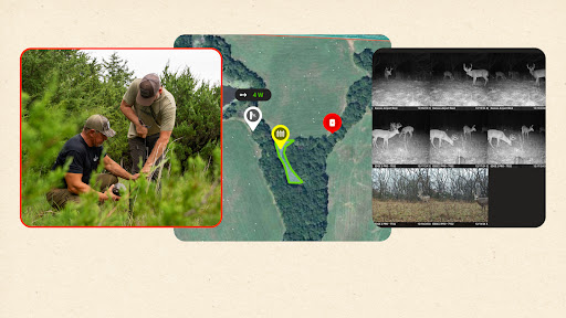
His instincts. Your intel. Show him how you do it with onX Hunt and integrate your trail cameras to view mapped movement. Filter photos by location and see every camera, photo, and update in one place. Analyze trail camera movement and find success on the hunt together with sharper tools.
前往活动页面版本
varies_with_device_2026-10-15更新时间
描述
版本
varies_with_device_2026-09-25更新时间
描述
版本
varies_with_device_2026-09-11更新时间
描述
版本
varies_with_device_2026-08-28更新时间
描述
版本
varies_with_device_2026-08-18更新时间
描述
版本
varies_with_device_2026-08-14更新时间
描述
版本
varies_with_device_2026-08-03更新时间
描述
版本
varies_with_device_2026-07-17更新时间
描述
版本
varies_with_device_2026-07-10更新时间
描述
当前排名
#1
近 30 天最佳: #1
上期排名: #1
2026年11月3日

App Store
相关应用
8
监测到的广告渠道
174
监测到的国家与地区
另监测到 5 个分组
另监测到 171 个分组
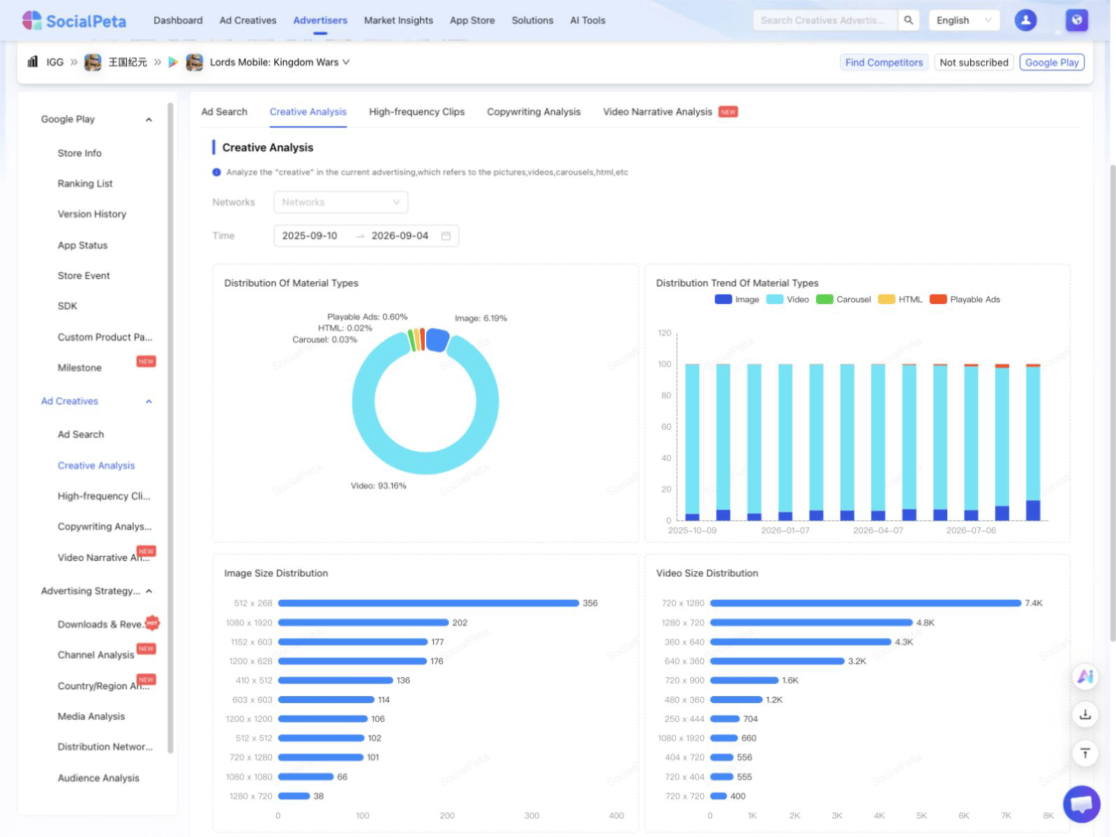 产品界面预览
按形式、尺寸和时长分析素材,也可查看常用片段与文案
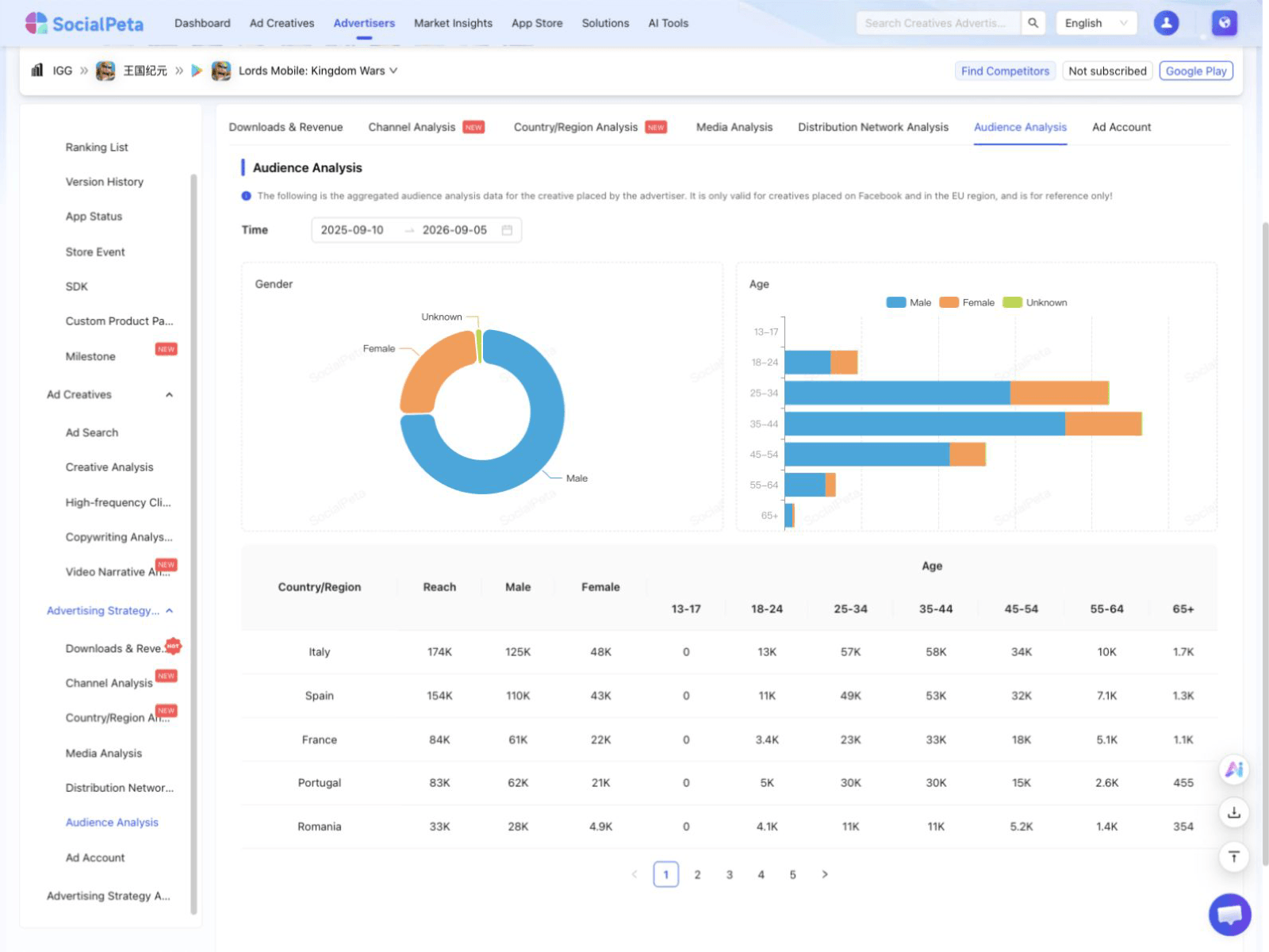 产品界面预览
查看受众、媒体、网盟、渠道、国家和分发平台
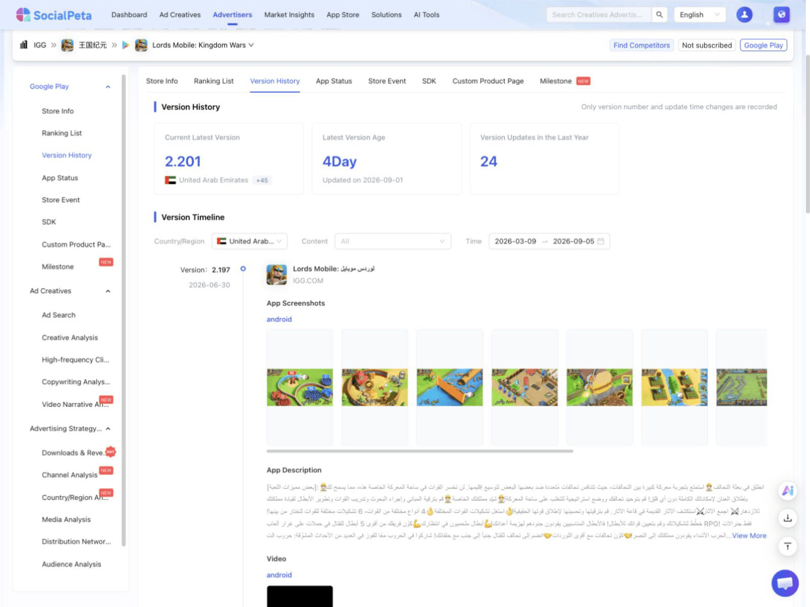 产品界面预览
查看版本、上架状态、商店活动、SDK 和自定义产品页的历史记录